Site selection for a hydroelectric power plant comes down to two numbers, head (the height the water falls) and flow (the volume per second the river can supply reliably), because the power available is P = ρgQHη. After that, the site must have sound rock for the dam, room for a reservoir or pondage, manageable silt, acceptable environmental and rehabilitation impact, and road and transmission access. This page explains each factor, works through the power equation and a catchment runoff estimate, compares storage, run-of-river and pumped storage sites, and uses Bhakra, Tehri, Koyna and Nathpa Jhakri as Indian examples.
Why head and flow decide a hydro site
A hydro plant turns the potential energy of water into electricity. The power it can make is:
P = ρ × g × Q × H × η
- ρ = density of water, 1,000 kg/m3
- g = 9.81 m/s2
- Q = flow through the turbines, m3/s
- H = net head, m (gross head minus losses in the intake, tunnel and penstock)
- η = overall efficiency of turbine and generator, typically 0.85 to 0.92
With ρ and g fixed, a handy shortcut is P (kW) ≈ 8.8 × Q × H at 90 percent efficiency. Power depends on the product of flow and head, so a site can win either way. A Himalayan stream with a few tens of m3/s falling several hundred metres can match a large plains river with a head of only 20 to 30 m. The head also decides the turbine: Pelton wheels for high heads, Francis turbines for medium heads, and Kaplan or bulb turbines for low heads and large flows.
Worked example: power and annual energy
A site offers Q = 100 m3/s at a net head H = 80 m, with an overall efficiency η = 0.9.
- P = 1,000 × 9.81 × 100 × 80 × 0.9 = 70,632,000 W = 70.6 MW
- Check with the shortcut: 8.8 × 100 × 80 = 70,400 kW, about 70.4 MW
- Annual energy at a capacity factor of 50 percent: 70.632 MW × 8,760 h × 0.5 = 309,368 MWh = about 309 GWh per year
The capacity factor matters because river flow is not constant. Many Indian hydro plants run hard through the monsoon and snowmelt months and much less in winter, so their capacity factor is well below that of a coal plant. Use the real figure for the river when you size a project.
Catchment area in a hydro power plant
The catchment area (drainage basin) is all the land that drains rain and snowmelt into the river above the dam site. Its size, rainfall, slope, soil and forest cover set how much water arrives, and when. A first estimate of the average flow uses a runoff coefficient:
Annual runoff volume = catchment area × annual rainfall × runoff coefficient
The runoff coefficient is the fraction of rain that reaches the river instead of soaking in or evaporating. It is higher for steep, rocky or snow-fed catchments and lower for flat, forested or sandy ones.
Worked example: mean flow from a catchment
Take a catchment of 5,000 km2, an average annual rainfall of 1,500 mm and a runoff coefficient of 0.5.
- Area = 5,000 km2 = 5,000 × 106 m2 = 5 × 10⁹ m2
- Rainfall = 1.5 m
- Runoff volume = 5 × 109 × 1.5 × 0.5 = 3.75 × 10⁹ m3 per year
- Seconds in a year = 365 × 24 × 3,600 = 31,536,000 s
- Mean flow = 3.75 × 10⁹ ÷ 31.536 × 106 = 118.9 m3/s
At an 80 m head and 90 percent efficiency, that average flow would support about 1,000 × 9.81 × 118.9 × 80 × 0.9 = 84 MW on average. The real plant rating depends on how that flow is spread through the year, which is where the flow duration curve comes in.
Flow duration curve and firm power
A flow duration curve plots river flow against the percentage of time that flow is equalled or exceeded, built from as many years of gauge records as are available. The flow available 90 percent or more of the time sets the firm power, the output the plant can promise almost all year. Flows available less often give secondary power that is sold when it comes. A reservoir flattens the curve by storing monsoon water for the dry season, which raises firm power. Long, reliable hydrological data is therefore one of the first things a site survey needs.
Storage, run-of-river and pumped storage sites
| Scheme | What the site needs | Strength | Weakness |
|---|---|---|---|
| Storage (reservoir) | A wide valley upstream of a narrow gorge, so a dam can store a large volume | Firm power, peak supply, flood control and irrigation | Large submergence, rehabilitation and sedimentation |
| Run-of-river | Steep river gradient; a low diversion dam and a long tunnel to gain head | Small reservoir, smaller submergence | Output follows river flow; low in winter |
| Pumped storage | Two reservoirs close together horizontally but far apart vertically | Stores surplus power, helps balance solar and wind | Consumes more energy than it returns; needs a suitable second reservoir |
For a pumped storage site the key number is the ratio of head to horizontal distance between the upper and lower reservoirs: a high head over a short distance keeps tunnels short and cheap. Existing reservoirs are attractive, which is why the Tehri complex added a pumped storage plant between the Tehri and Koteshwar reservoirs.
Dam site geology
The dam is usually the most expensive part of the project, and the rock under it decides whether it can be built safely.
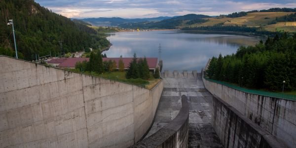
- A narrow gorge with a wide valley upstream. A short dam then holds back a large reservoir.
- Sound, impervious rock in the foundation and both abutments, without large faults, shear zones or cavities. Weak zones are treated by grouting, but a bad site cannot be fully fixed.
- Dam type follows the geology. Concrete gravity and arch dams need strong rock; earth and rockfill dams tolerate weaker foundations and use local fill.
- Seismicity. The Himalaya is one of the most earthquake-prone mountain belts, so dams there are designed for strong shaking, and tunnels must cross squeezing and fractured rock. Large reservoirs can also trigger earthquakes.
- Reservoir rim stability. Landslides into a reservoir can cause waves and fill it with debris, so the valley slopes are surveyed too.
Sedimentation and reservoir life
Rivers carry silt, and Himalayan rivers carry a great deal of it, especially during the monsoon. When the water slows in a reservoir, the silt settles and fills the storage volume. The useful life of a reservoir is set by how fast its live storage fills, so planners estimate the sediment load from the catchment and provide dead storage below the outlets to hold it. Catchment treatment (afforestation, check dams) slows erosion. In run-of-river plants the problem moves to the turbines: fine hard sand wears runners and nozzles, so these projects need desilting chambers before the water enters the headrace, and periodic flushing.
Environmental and rehabilitation issues
- Submergence and displacement. A reservoir floods villages, farmland and forest. More than 100,000 people were relocated for the Tehri dam, and resettlement disputes delayed the project.
- River ecology. Dams block fish migration and change downstream flow, temperature and sediment. Projects must release an environmental flow downstream and may need fish passes.
- Clearances. In India a large hydro project needs environmental and forest clearances with public hearings, as well as techno-economic approval of its design from the Central Electricity Authority.
Access, construction and transmission
Many good hydro sites are in remote valleys. Roads and bridges must carry heavy turbine and transformer parts, and the site needs space for construction plant, labour colonies and muck disposal from tunnels. The power then has to reach load centres over long transmission lines through hilly terrain, so the cost of the line and its right of way is part of the site decision.
Indian hydro sites as examples
| Project | Type and site | Key facts |
|---|---|---|
| Bhakra, Himachal Pradesh | Storage; concrete gravity dam in a gorge of the Sutlej | 226 m high, completed 1963; Gobind Sagar reservoir about 9.34 billion m3 gross; 1,325 MW installed; also serves irrigation and flood control |
| Tehri, Uttarakhand | Storage; earth and rockfill dam on the Bhagirathi | 260.5 m, India’s highest dam; 1,000 MW main plant (2006), 400 MW Koteshwar downstream and a 1,000 MW pumped storage plant; sits in a seismic gap of the central Himalaya |
| Koyna, Maharashtra | Storage in the Western Ghats | 103.2 m rubble-concrete dam; project capacity about 1,960 MW; the 1967 Koynanagar earthquake (Mw 6.6) struck nearby, and whether the reservoir triggered it is still debated |
| Nathpa Jhakri, Himachal Pradesh | Run-of-river on the Sutlej | 67.5 m diversion dam, 27.4 km headrace tunnel to an underground powerhouse, 428 m head, 1,500 MW (6 × 250 MW Francis), commissioned 2004 |
Nathpa Jhakri shows the run-of-river trade: a modest dam and modest flow, but a long tunnel along a steep river gains more than 400 m of head. Bhakra and Tehri show the storage approach: a very high dam in a narrow gorge creates a large reservoir behind it.
How this differs from thermal and nuclear siting
A hydro plant must go where the river and the rock are, while thermal plant siting is driven by coal, cooling water and ash disposal, and nuclear plant siting by exclusion zones, population and seismic safety. The US Department of Energy has a short overview of the types of hydropower plants.
Site selection checklist for a hydro power plant
| Factor | What to check |
|---|---|
| Head | Available gross and net head; river gradient; turbine type it implies |
| Flow | Long-term gauge records, flow duration curve, firm and mean flow |
| Catchment | Area, rainfall and snowmelt, runoff coefficient, glaciers |
| Storage | Valley shape, reservoir volume per metre of dam height, pondage needs |
| Geology | Foundation and abutment rock, faults, tunnel rock quality, slope stability |
| Seismicity | Seismic zone, nearby active faults, design earthquake |
| Sediment | Silt load, reservoir life, desilting and flushing arrangements |
| Environment and people | Submergence, forest land, displacement, environmental flow, clearances |
| Access and transmission | Roads for heavy parts, construction space, distance to the grid and load centres |
| Other uses | Irrigation, drinking water, flood control and interstate water sharing |
FAQs
What are the main factors in site selection of a hydro power plant?
Head and reliable flow come first, since power is P = ρgQHη. Then come catchment and rainfall, storage space, dam site geology and seismicity, silt load, environmental and rehabilitation impact, and access and transmission.
What is the catchment area in a hydro power plant?
It is the whole area of land that drains into the river above the dam. Its size, rainfall and runoff coefficient decide how much water reaches the plant each year.
How much power does 100 m3/s at 80 m head give?
At 90 percent efficiency, P = 1,000 × 9.81 × 100 × 80 × 0.9 = 70.6 MW. At a 50 percent capacity factor that is about 309 GWh a year.
Why are dams built in narrow gorges?
A narrow gorge with a wide valley upstream lets a short dam store a large volume of water, and gorges often expose sound rock for the foundation and abutments.
What is the difference between storage and run-of-river sites?
A storage site uses a high dam and a large reservoir to hold water for the dry season. A run-of-river site uses a low diversion dam and a tunnel to gain head, with little storage, so its output follows river flow.